Google Maps is one of my favorite apps when I travel. Since I’m working online while traveling around, I arrive in a new city every few months. Google Maps is my main source to explore places. Let me explain how.
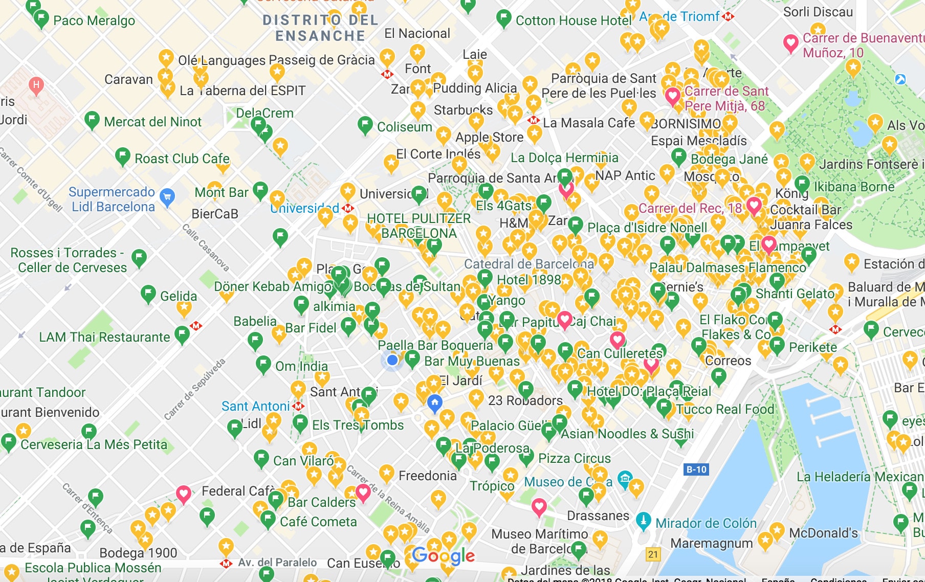
Maps has a very handy feature to mark places. They distinguish three options. I use them in the following manner;
- ⭐️ Stars to mark places where I have been;
- ? Flags to mark places where I want to go;
- ❤️ Hearts to mark places where friends live.
Maybe that’s nothing special, I know. But the best ideas always are very simple.
By doing this, I can see at a glance which areas I’m still missing out.
Furthermore, when I star a place, I often discover it happens to be very close to another of my marked ones. Like this, I find it very handy to discover how streets, squares and places of a city are structured.
The map of my favorite city Barcelona looks like this right now… ?